|
Anquet Maps 
|
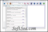
Anquets map software provides easy to use route planning tools with digital maps for PCs, Pocket PCs and Smartphones. The map software can also be used to directly program routes and waypoints into GPS units. The map software is called Anquet which includes a portable version called Pocket Anquet. There is no charge for these comprehensive tools. You only pay for the digital maps you select from cartographers such as Ordnance Survey, Philips, Harvey, Getmapping. Anquet is a licensed partner of all these organisations.
1. Map types
Seamless, continuous map data, that loads in the background as you navigate around the map with either cursor keys or a mouse. Access a variety of map scales, providing different levels of detailed mapping.
2. Zoom
Zoom in for a close look at your favourite spots, or zoom out for a more sweeping view of the area.
3. Route Planning Tools
View spot height data as you plot and save waypoints and paths, creating annotated routes quickly and easily. View associated gradient profile and adjustable Naismith's Rule walk statistics. Customise the appearance of waypoints and routes.
4. Find Place
Locate places using the built-in Gazetteer with over 250,000 listed items. Find any village, river, hill, etc. using search filters. Sort results by distance from current location, or alphabetically.
5. Printing
Move the map to select exactly the area you wish to print. Select the area, size and scale of printout, and make unlimited A4 prints for personal use. Options for printing multi page routes with selected overlaps
6. Options
Select your preferred: unit of measure, coordinate type, display options, auto-zoom settings, path and path profile settings, etc.
7. Anquet Virtual Landscape
Provides continuous 3D mapping with no tile edges or gaps. View and fly over the maps at any height, angle or direction. A split screen view lets you work simultaneously on both map and Virtual Landscape and you can automatically fly along a route of your choice so you can view the terrain you will be crossing.
8. Split Screen Viewing
View any pair of maps in Split Screen mode and synchronise one to the other.
9. Go to Grid reference
Jump directly to OS, National Grid or Lat/Long coordinates.
10. The Anquet Data Explorer
Provides a set of powerful data management tools with which users can manage their routes and waypoints in a variety of ways. Information can be filed in different databases to aid management of route and waypoint data.
The license of this software is Freeware, you can free download and free use this graphing software.
