|
Equatorial Coordinates Model 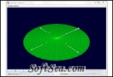
|
Analyze star position with this application. Equatorial Coordinates model displays the position of a star in equatorial (Right Ascension/Declination --- RA/Dec) coordinates. The horizon is shown along with the four cardinal directions (N, E, S, and W). The Latitude slider changes the latitude of the observer which is shown by the change in the (teal) celestial pole relative to the northern horizon. The position of the star can be changed by using the Right Ascension and Declination sliders. Once these coordinates are selected, pressing the play button will put the star, celestial grid, and the equatorial coordinates in motion to simulate the 23 hour and 56 minute motion of stars in the night sky.
This program simulates the position of a star in equatorial (Right Ascension/Declination --- RA/Dec) coordinates. The horizon is shown along with the four cardinal directions (N, E, S, and W). The Latitude slider changes the latitude of the observer which is shown by the change in the (teal) celestial pole relative to the northern horizon. The position of the star can be changed by using the Right Ascension and Declination sliders. Once these coordinates are selected, pressing the play button will put the star, celestial grid, and the equatorial coordinates in motion to simulate the 23 hour and 56 minute motion of stars in the night sky. This simulation is part of a sequence of simulations used to introduce students to local coordinates, equatorial coordinates, and the celestial globe. These additional simulations can also be found on the OSP ComPADRE site.
1. Local Coordinates Frame
2. Display Options Menu
3. Show Cardinal Arrows: show a second frame that displays a view of the sky overhead as seen by the observer whose horizon plane is shown in the Celestial Globe frame.
4. Show Star Trail: show the path of the star in the sky over the course of a sidereal day.
5. Show Star Motional Plane: show the plane that represents the star's motion over the course of a sidereal day.
6. Show Celestial Axis: show the celestial axis.
7. Show Celestial Grid: show the celestial coordinate grid (equatorial coordinates.
8. Show Celestial Equator: show the plane of the celestial equator.
9. Show Stars: show points representing stars.
Visual Elements
1. Orange arrow: arrow from observer to the point with the right ascension and declination given by the sliders.
2. White dot: star with the right ascension and declination given by the sliders.
3. Green plane: the horizon plane of an observer on Earth. Objects above the horizon are visible to the observer, objects below the horizon are not.
4. Black arrows (and labels): points in the four cardinal direction along the horizon plane.
5. Teal line: the celestial pole.
Requirements:
* Java
The license of this software is Freeware, you can free download and free use this graphing software.