|
Lasertool 
|
The Laserscan tool processes point clouds and generates those nice looking images. In its current form, this is a very basic command line tool without many options.
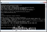
Usage of the command line tool (can also be seen by calling the program without arguments):
lasertool [options] <input file(s)>
Options can be [defaults in square brackets]:
-r <resolution> - specify the meters per pixel of the output images [1]
-h <white_height> - height (in meters) which should be displayed as white in the vegetation height image [15]
-c <cells> - number of grid cells per dimension used for speeding up neigbour tests. Trade off between memory and performance. [256]
-las-ground <x> - use x as ground classification in las files [2]
-asc-ground <x> - use x as ground classification in asc files [1]
Input files can be .las and .asc files
If more than one input file is given, the files are merged.
.asc text files must consist of lines of the following structure:
x y z class
where every line specifies a point.
The license of this software is Free, you can free download and free use this graphing software.
