|
Martis 
|
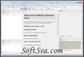
Martis can create and edit GPS vector maps, a software program that lets you create and edit GPS vector maps visually with the focus on Garmin devices and maps.
A special attention was given ease of use. If you ever worked with a vector graphics program youll be familiar with creating Maps in a minimum of time. You just have to draw some lines and points. However, the creation of GPS maps is not a trivial task and it takes a lot of time to create a good map even for a small area.
With Martis you can:
1. Create new Maps for your Garmin device.
2. Import and edit existing maps from various formats and sources.
3. Can download Maps from OpenStreetMap.
4. Edit maps just like as in other vector graphics programs.
5. Capture position data from a connected GPS device and record tracks.
6. Calculate short and/or fast routes.
Martis Lite Features:
1. Load and Save Maps in Polish Format, OSM and its own XML like file format.
2. Load ESRI shape, MapInfo MIF and TAB files.
3. Load and Save Tracks, Routes and Waypoints in GPX format and KML.
4. Download maps from OpenStreetMaps.
5. Compile the map to a Garmin IMG file using cGPSmapper and/or mkgmap with just one click.
6. GPS Tracking using the Garmin protocol via USB and COM and NMEA via TCP/IP and COM. Automatically records the track in given interval and/or distance.
7. Simulate GPS position data.
8. Polyline and Polygon simplification using the Douglas Peucker Algorithm.
9. Route finding using the A* algorithm.
10. Unlimited Undo/Redo and all other usual editing functions.
11. Guide Lines
12. Editing the map as like in any other vector graphics program.
13. Additional components: Alitmeter, Speedo meter (also for vertical speed), Compass, Altitude profile, Ruler (indicating map coverage, viewing area and GPS track pointer), threaded MiniMap.
14. Threaded search engine.
15. Map validation, find common pitfalls.
16. Add bitmaps to the map and georeference them. Read GPS position from EXIF data.
17. Support for Garmin Levels and Layers as found in other graphics programs.
18. Map legend.
19. Youre completely free how to arrange all the windows and you can even save them. If you know Delphi, its similar to Delphis Desktops.
20. Due to the use of separate threads for time expensive operations, it takes advantage of modern multi CPU/Core/Thread computers.
Supports the following projections (there are still some esoteric projections which are not (yet) implemented):
* UTM North
* UTM South
* British National Grid
* Dutch RD Grid
* Gauss Kruger, also known as Transverse Mercator
* Germany DHTN
* Irish Grid
* Irish Transverse Mercator
* New Zealand Map Grid
* New Zealand TM 2000
* Italy Zone 1
* Italy Zone 2
* Russian SK 42
* Swedish RT90 25 gon W
* Swiss Coordinate System
* Miller Cylindrical
* Mercator
* Albers Equal Area Conic
* Lambert Azimuthal Equal Area (Polar and Oblique)
* Lambert Conformal Conic
* Sinusoidial
* Equidistant Conic
* Cassini
* Stereographic (Polar and Oblique)
* Azimuthal Equidistant (Polar only)
The license of this software is Freeware, you can free download and free use this graphing software.
